If you’re on the lower tiers you can walk all the way around the lower tier concourses with the exception of the west stand. Same goes for the upper tier. Away fans, family enclosure and club view sections have their own individual concourses that can only be accessed from those areas.ok so is 3 quarters of the ground accessible for anyone via the upper level or has someone lied to me?
You are using an out of date browser. It may not display this or other websites correctly.
You should upgrade or use an alternative browser.
You should upgrade or use an alternative browser.


If you’re on the lower tiers you can walk all the way around the lower tier concourses with the exception of the west stand. Same goes for the upper tier. Away fans, family enclosure and club view sections have their own individual concourses that can only be accessed from those areas.
ok ermmmm i sit in the one moyes will be in
so do i get to misbehave and play hido?
Drico
Player Valuation: £60m
That's a lovely, imaginative touch.
Timbucktoo
Player Valuation: £15m
You can do so long as you pay for your food, that will not be tolerated as the test event showed.ok ermmmm i sit in the one moyes will be in
so do i get to misbehave and play hido?
EvertonLuc
Player Valuation: Free Transfer
Yeah that's fair enough, I have changed the petition to add 572 extra stones to make 36,572 which seems more realistic in all ways. I am sure a few still missed out so it gives a final opportunity, I'll float the idea around for extra 500. No big deal if they stick to the 36,000 but with so much time to finish stadium people may as well look into it.Don’t forget that capacity includes (roughly) 3,000 away fans. So 36,000 is just about right.
That means you’re are new throw in specialist.ok ermmmm i sit in the one moyes will be in
so do i get to misbehave and play hido?
Noggsy blue
Player Valuation: £8m
Everton Way, legends stones and a new home for Everton Heritage
The binman chronicles
Player Valuation: £80m
Super Kevin sheedy
Player Valuation: £10m
I’m in the Upper South in the corner, looks a good spec and I’m coming from the Gwladys Street, soz about thatI went for upper south. Quite near the back but I like being high up in stadiums.
As a park ender my only worry is slumming it with people from the Gwladys street.
Will make sure I always have some wipes and hand sanitizer with me.
JamesEFC
Player Valuation: £10m
Yeah I got a refund a few years ago for a season, they were quite reasonable about it just had to put it in writing and reason why.Pretty sure I heard him say that single seat looks like it might've been one returned to the club. Is that even possible if you've checked out and paid for it. Is there a grace period?
Once season starts obviously a different story
Roger Milla
Player Valuation: £20m
Just seen they've called it The Everton Stadium (obv until a sponsorship deal is in place), well that's crap. Bramley Moore Dock Stadium sounds much better.
It’s always officially been called the Everton Stadium.Just seen they've called it The Everton Stadium (obv until a sponsorship deal is in place), well that's crap. Bramley Moore Dock Stadium sounds much better.
I'll tell you then in a few words, its a GPS or VRS (Virtual Reference Station) that plots lots of points in a 3d frame, these points can be joined together in software that allows you to make drawings, based on either GPS signal (usually with a base head and a 'rover' head to get 2x triangulation), or the virtual reference station uses GPS and the phone mast network to triangulate its position.This just might be the most boring stadium video update we've ever had, "so erm, what does that high tech mop stick do again mate"
"I'm glad you asked, but it's so high tech I haven't got enough time to show you in this 3 minute video. But it's so high tech, that it's within a cm of the most high tech stuff in the world"
depending on the accuracy of the GPS network and its use, it can be down to a couple of mm accuracy if all the corrections are used to allow for gps positioning 'errors' and atmospheric distortion of the GPS signal as it passes through the atmosphere.
TLDR, it plots points in 3d and puts them on a map of the world
Still a high tech mop though isn't it.I'll tell you then in a few words, its a GPS or VRS (Virtual Reference Station) that plots lots of points in a 3d frame, these points can be joined together in software that allows you to make drawings, based on either GPS signal (usually with a base head and a 'rover' head to get 2x triangulation), or the virtual reference station uses GPS and the phone mast network to triangulate its position.
depending on the accuracy of the GPS network and its use, it can be down to a couple of mm accuracy if all the corrections are used to allow for gps positioning 'errors' and atmospheric distortion of the GPS signal as it passes through the atmosphere.
TLDR, it plots points in 3d and puts them on a map of the world
Only joking mate

Shop
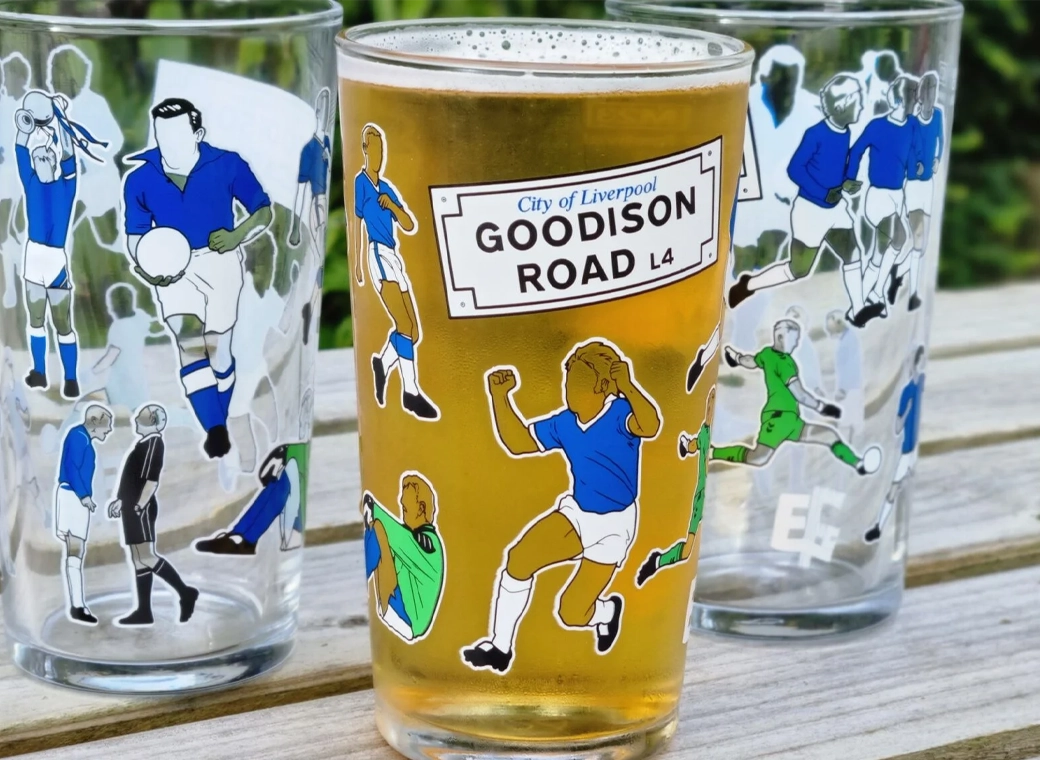
Everton Pint Glass
Our exclusive Everton pint glasses are a true collector’s item that pays homage to Goodison Park through iconic players who have graced the pitch over different generations.
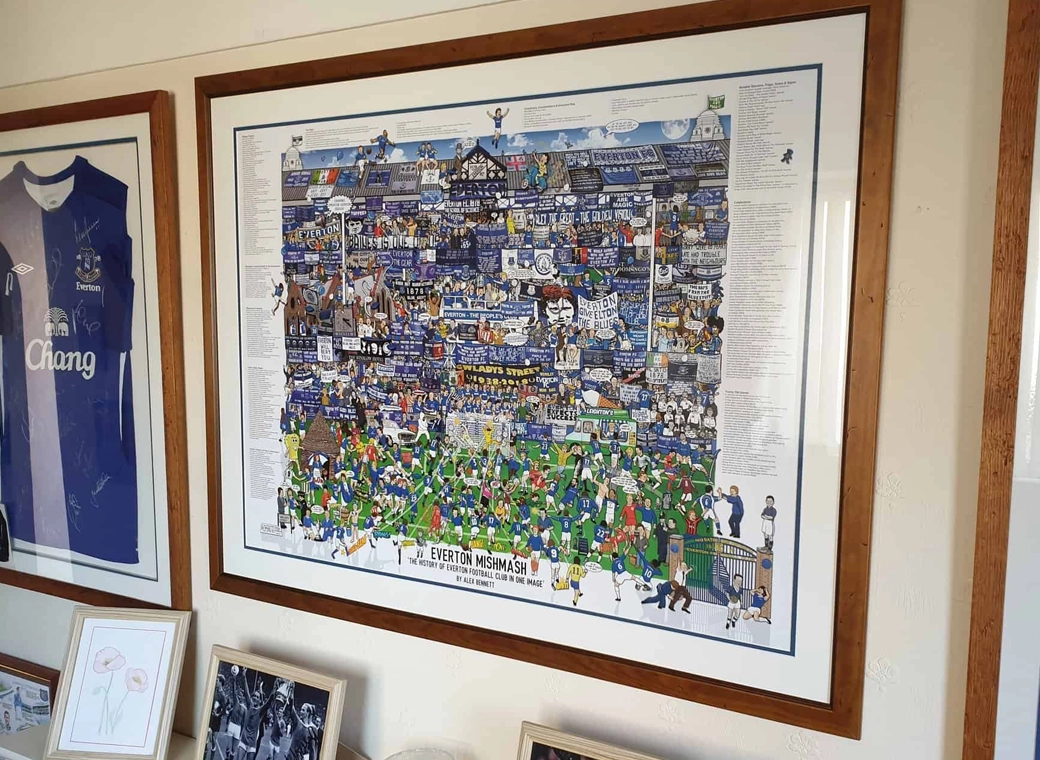
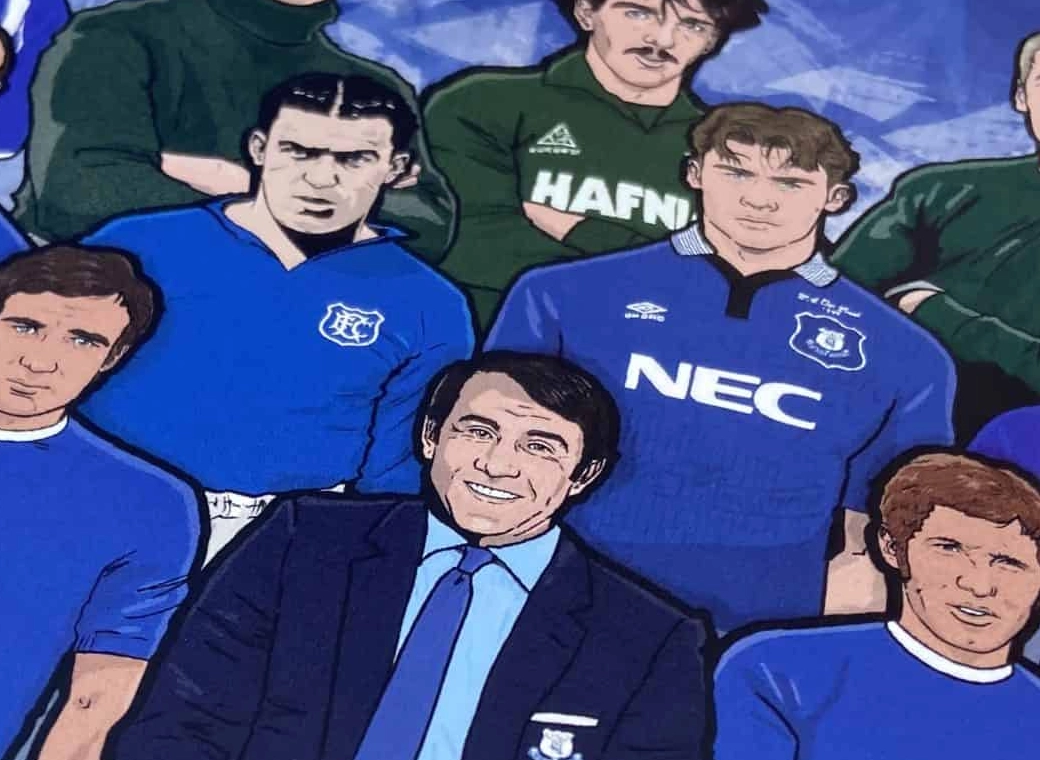
Everton Mishmash
The history of Everton FC in one image! “The best Everton thing I’ve ever got!”
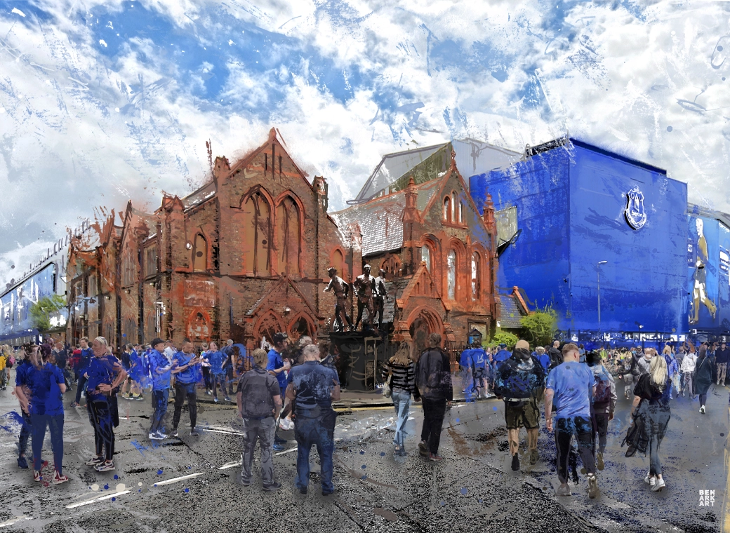
Goodison Park - Blue Skies
A truly, wonderful piece which brings memories of visits to Goodison Park alive.
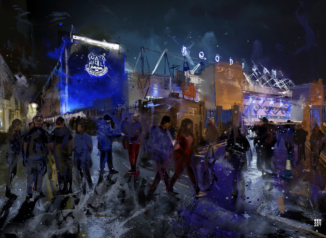
Goodison Park - Under The Lights
This print wonderfully encapsulates the magic of the ‘Goodison Under The Lights’.
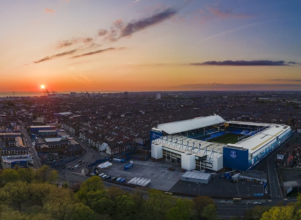
Goodison Park - Sunset
A wonderful, A3 aerial print of Goodison Park.
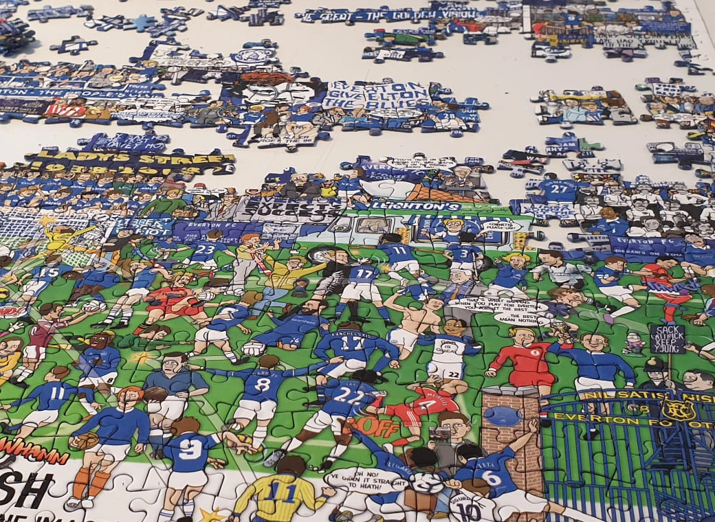
Everton Jigsaw
A special, limited edition 1,000 piece jigsaw of the popular Everton Mishmash – The History Of Everton FC In One Image!
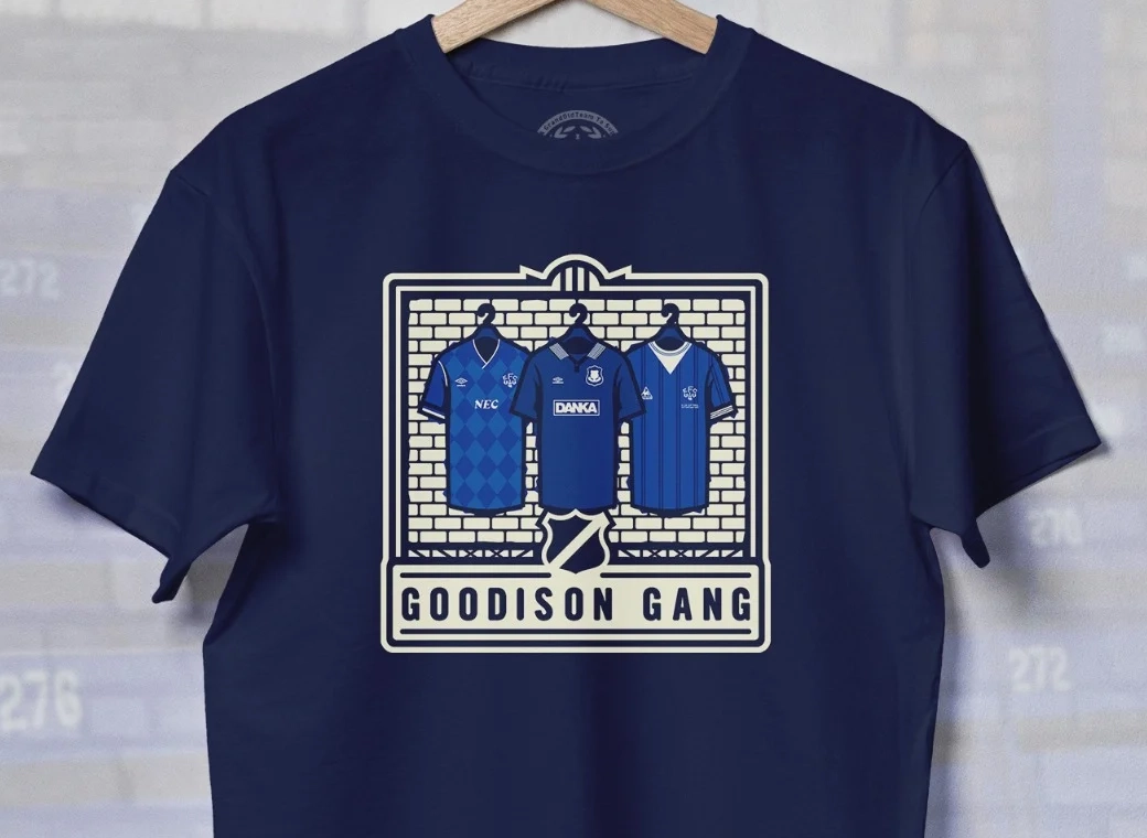
Goodison Gang T-Shirt
Introducing our Goodison Gang Everton T-Shirt.
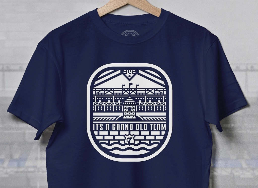
Grand Old Team T-Shirt
Our newest Everton T-Shirt.
Legends of Goodison Park
Everton champions, legends, and long-time servants assembled together in one squad photo!