Seamus Colemole
Previously deathbyropeandglass
How can that be true? Don't understand how it can have the most Easterly?
Great thread though. Will have to find some cool facts to contribute")
http://www.worldatlas.com/aatlas/infopage/nsewusa.htm

How can that be true? Don't understand how it can have the most Easterly?
Great thread though. Will have to find some cool facts to contribute
Hmmm. May well be in the Eastern Hemisphere, but it's still West of the rest of the US. By that method of determining it, whatever the end of Russia is there is it's most Westerly point...
Maybe it's due to the curvature of the Earth - it may be more easterly at the very top, at it's closest to the North Pole where the planet's arc would take it east as well as north?Hhhhhhmmm yeah that does sound a bit odd. I'd assume the 180 degree line goes round the edge of Russia but through the middle of the last few Aleutian islands.
I don't think the lines of longtitude are technically straight like in that pic and are jaggered.
But i'm slightly confused now.
Known in the trade as a dummy lyric. The lyric to the old standard 'Tea for Two' was actually just a dummy lyric. The writer took it to his producer or manager (can't remember all the details or even who the hell wrote it) who loved it. The writer then said he'd get back to him when he'd written the real lyric only to be told not to change it. It was great as it was. Became a massive hit back in the day.Paul woke up one morning in his top floor bedroom at the Asher's home in Wimpole Street with the tune for 'Yesterday' in his head. There was a piano by the bed and he went straight to it and started playing. "It was just all there," he said. "A complete thing, I couldn't beleive it."
Although at that point it had no lyric, Paul was worried that the tune itself might have been unconsciously plagiarized, and that what had seemed like a flash of inspiration may only have been a surge of recollection. "For about a month, I went round to people in the music business and asked them wether they had ever heard it before," he said. "Eventually it became like handling something into the police. I thought that if no-one claimed it after a few weeks then I would have it."
He then came up with the provisional title 'Scrambled Eggs' and began singing 'Scrambled eggs, Oh you've got such lovely legs', simply to get a feel for the vocal.
Hhhhhhmmm yeah that does sound a bit odd. I'd assume the 180 degree line goes round the edge of Russia but through the middle of the last few Aleutian islands.
I don't think the lines of longtitude are technically straight like in that pic and are jaggered.
But i'm slightly confused now.
I'm lost with your confusion. Some of the Aleutians are in the east. Lat and longs are straight too plus they converge whereas eastings and northings are parallel.Maybe it's due to the curvature of the Earth - it may be more easterly at the very top, at it's closest to the North Pole where the planet's arc would take it east as well as north?
This is just a guess folks.
I'm lost with your confusion. Some of the Aleutians are in the east. Lat and longs are straight too plus they converge whereas eastings and northings are parallel.
Ah right OK..I posted the pic above to demonstrate how Alaska can be the most Easterly, and Westerly state of the US. It shows how the Aleution Islands cross over the 180 degree line seperating East and West.
Thats the simple bit.
I think the confusion comes from when @Philw pointed out that the far East point of Russia in that pic also crosses over the 180 degree line, which should then make that part of Russia the most Westerly point (using the Alaska logic).
Yet when i look it up on google it says the most Westerly part of Russia is https://en.wikipedia.org/wiki/Kaliningrad_Oblast
which is a small bit of land North of Poland.
Then there's this..I posted the pic above to demonstrate how Alaska can be the most Easterly, and Westerly state of the US. It shows how the Aleution Islands cross over the 180 degree line seperating East and West.
Thats the simple bit.
I think the confusion comes from when @Philw pointed out that the far East point of Russia in that pic also crosses over the 180 degree line, which should then make that part of Russia the most Westerly point (using the Alaska logic).
Yet when i look it up on google it says the most Westerly part of Russia is https://en.wikipedia.org/wiki/Kaliningrad_Oblast
which is a small bit of land North of Poland.

I heard that South America is much larger than it appears on the maps.Peters map,have a google of this,it appears the world maps are wildly not accurate.in land mass size Greenland looks roughly the same size as Africa,when apparently Greenland is 14 times smaller.
there's errors all over the world map and a good read in wikipedia.
Hhhhhhmmm yeah that does sound a bit odd. I'd assume the 180 degree line goes round the edge of Russia but through the middle of the last few Aleutian islands.
I don't think the lines of longtitude are technically straight like in that pic and are jaggered.
But i'm slightly confused now.

Our exclusive Everton pint glasses are a true collector’s item that pays homage to Goodison Park through iconic players who have graced the pitch over different generations.
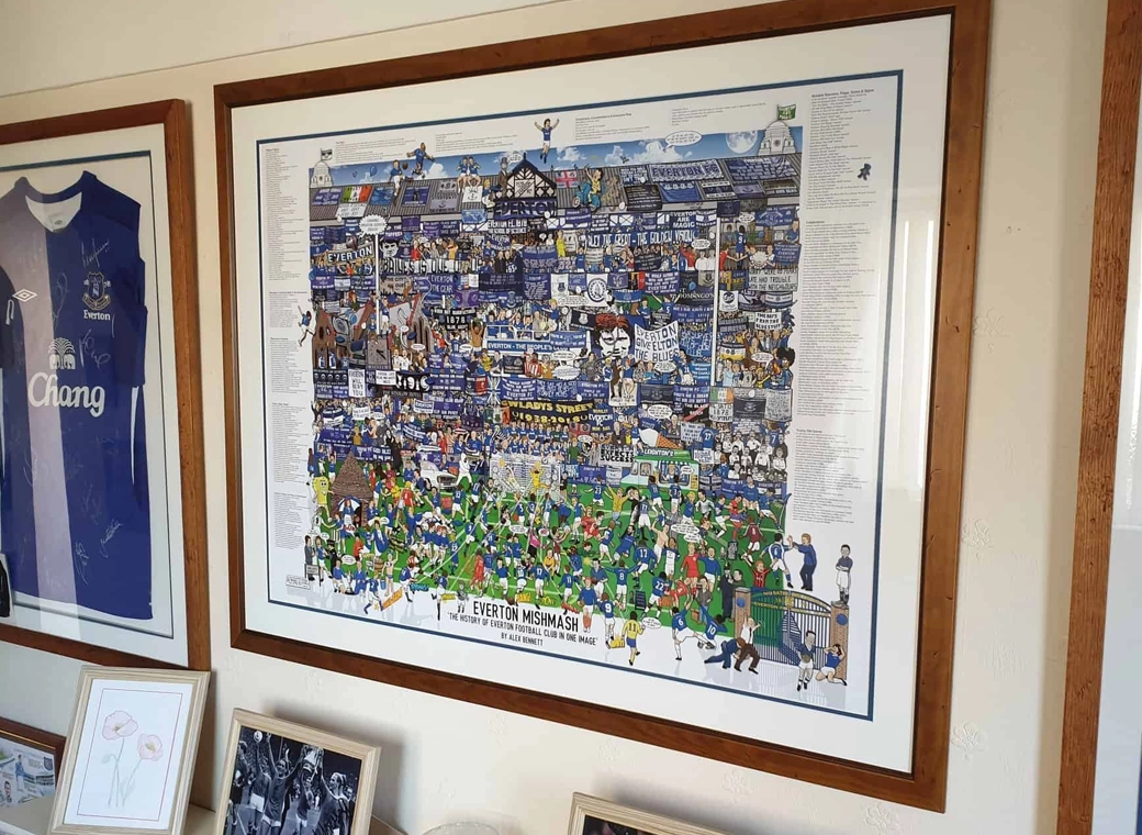
The history of Everton FC in one image! “The best Everton thing I’ve ever got!”

A truly, wonderful piece which brings memories of visits to Goodison Park alive.

This print wonderfully encapsulates the magic of the ‘Goodison Under The Lights’.
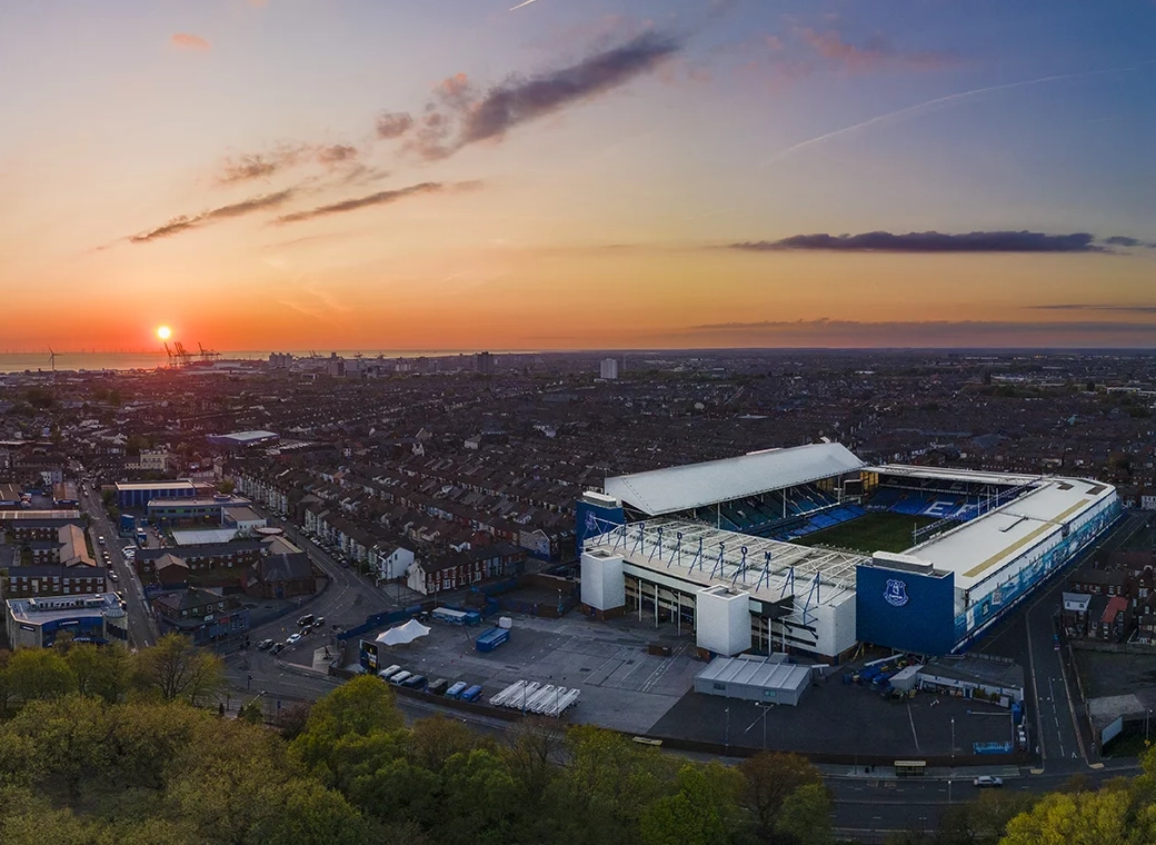
A wonderful, A3 aerial print of Goodison Park.

A special, limited edition 1,000 piece jigsaw of the popular Everton Mishmash – The History Of Everton FC In One Image!

Introducing our Goodison Gang Everton T-Shirt.

Our newest Everton T-Shirt.

Everton champions, legends, and long-time servants assembled together in one squad photo!