Virgins.

Virgins.
HAHHAHAHAHAHAHAHA!!!!!!!
A fan... of planes? This like trainspotting? fo'real? AND you own guns?
A professional approach (with autopilot help; unfortunately no ATC radios)
Have you seen The Hunt for Red October? The part where they are doing that high speed canyon run and the Navigator said he could navigate the Alps in a plane with no windows with just a stopwatch, compass and map?
Yeah, thats me. Underwater navigation. So they guy there landing on instruments are what submarines do every single day once submerged.
I'm not sure how subs navigate under water, maybe @Dylan could explain a little, but I imagine its similar to ships and planes, great circle, with rhumb lines etc, I might be well wide of the mark.Fair point, but between instrumentation and the fluid dynamics or air (and speed of craft), I'm guessing there are a few differences.
But yes, if you can conceptualize yourself flying in the dark, it goes a long way to competent navigation.
I'm not sure how subs navigate under water, maybe @Dylan could explain a little, but I imagine its similar to ships and planes, great circle, with rhumb lines etc, I might be well wide of the mark.
At least on ships and planes you can use celestial navigation to check your instruments, would be interesting to know how subs check their nav equipment.
So quite similar, and interesting how you calculate set and drift for dead reckoning.Ok. The methods will vary a bit based on available inputs.
Celestial navigation is no longer required onboard US Navy ships, as we have GPS (I would like to point out that we still carry sextants and all the log tables on board just in case, and I took it upon myself to teach myself celestial navigation out of the books). GPS can still be encrypted, inserting errors into the positions given by commercial units that don't have the encryption key. If the poop hit the fan, those errors would be inserted and only military GPS would be accurate.
Now, for GPS to work, you need LOS to those satellites. 2 satellites gives a poor fix. 3 gives a fair, 4 gives a good and 5 gives an excellent fix, with full 3D spatial positioning (altitude man!!!!).
As such, underwater, a submarine doesn't have LOS to those satellites, so we use estimated positions. On the fast attack, we use RLNG's (Ring Laser Gyro Navigators) which generally give you a position error of around 1nm over a week-ish. On the boomers, we use ESGN's (Electrostatically Suspended Gyro Navigators) which have a much higher accuracy. I can't give you the numbers as I would get into trouble, as we keep that a guarded secret, but put it this way - they are accurate enough to shoot Nuclear Weapons with (and the fallacy of not needing good accuracy due to the BOOM is untrue....strategic weapons need a high degree of accuracy). Every so often (again, can't tell you how often) we reset the ESGN position to a GPS fix.
Of course we have other methods as well, should the GPS constellation be destroyed, so we can fix our position using bathymetric fixes, or we just do the old fashioned DR (dead reckon) where we say, "this direction with this speed, with this set & drift over this period of time means we are here" Obvs this is subject to accurate set & drift and having a good helm who steers his course well. And making sure you update your DR constantly due to changes.
Set & Drift......we calculate that underwater by using EM Logs. Two large paddles that stick out the bottom of the sub on either side. An electrostatic field is generated around them, and it takes inputs from the SCAP (Ship control and Alarm Panel - which is electronic readings from the ships gyro for heading and from the engine room for shaft speed). It then measures the electrostatic field distortion and compares it to the inputs. The difference is the speed and direction of the ocean current.
We use Mercator projection charts, and will often chart direct and great circle routes as a matter of routine. As part of the navigation division, we learn it all....electronic navigation, visual navigation, radar navigation, bathymetric navigation. We need to be able to do it all if our primary sources fail for whatever reason.
Question? As you might be able to tell, I would be happy to answer them.
I'm not sure how subs navigate under water, maybe @Dylan could explain a little, but I imagine its similar to ships and planes, great circle, with rhumb lines etc, I might be well wide of the mark.
At least on ships and planes you can use celestial navigation to check your instruments, would be interesting to know how subs check their nav equipment.


As such, underwater, a submarine doesn't have LOS to those satellites, so we use estimated positions. On the fast attack, we use RLNG's (Ring Laser Gyro Navigators) which generally give you a position error of around 1nm over a week-ish. On the boomers, we use ESGN's (Electrostatically Suspended Gyro Navigators) which have a much higher accuracy. I can't give you the numbers as I would get into trouble, as we keep that a guarded secret, but put it this way - they are accurate enough to shoot Nuclear Weapons with (and the fallacy of not needing good accuracy due to the BOOM is untrue....strategic weapons need a high degree of accuracy). Every so often (again, can't tell you how often) we reset the ESGN position to a GPS fix.

Our exclusive Everton pint glasses are a true collector’s item that pays homage to Goodison Park through iconic players who have graced the pitch over different generations.

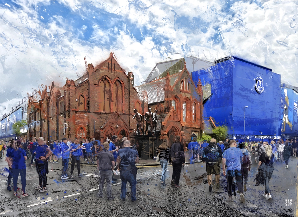
The history of Everton FC in one image! “The best Everton thing I’ve ever got!”
A truly, wonderful piece which brings memories of visits to Goodison Park alive.

This print wonderfully encapsulates the magic of the ‘Goodison Under The Lights’.
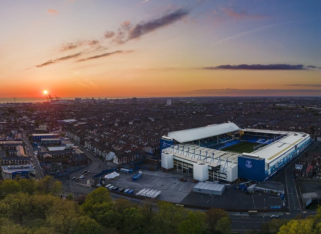
A wonderful, A3 aerial print of Goodison Park.

A special, limited edition 1,000 piece jigsaw of the popular Everton Mishmash – The History Of Everton FC In One Image!

Introducing our Goodison Gang Everton T-Shirt.

Our newest Everton T-Shirt.

Everton champions, legends, and long-time servants assembled together in one squad photo!